Samuel S. Lewis State Park
IUCN Category IIIParks in York County, PennsylvaniaProtected areas established in 1954Protected areas of York County, PennsylvaniaState parks of Pennsylvania ... and 1 more
Use mdy dates from August 2023

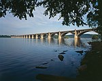
Samuel S. Lewis State Park is an 85-acre (34 ha) Pennsylvania state park in Lower Windsor Township, York County, Pennsylvania, in the United States. Mt. Pisgah is an 885-foot-high (270 m) ridge that is the focus of recreation for the park. The ridge separates East Prospect Valley from Kreutz Creek Valley. An overlook on Mt. Pisgah gives visitors of view of the Susquehanna River Valley. Samuel S. Lewis Park is twelve miles (19 km) east of York near U.S. Highway 30.
Excerpt from the Wikipedia article Samuel S. Lewis State Park (License: CC BY-SA 3.0, Authors, Images).Samuel S. Lewis State Park
Samuel S. Lewis State Park, Lower Windsor Township
Geographical coordinates (GPS) Address Nearby Places Show on map
Geographical coordinates (GPS)
| Latitude | Longitude |
|---|---|
| N 39.996388888889 ° | E -76.549166666667 ° |
Address
Samuel S. Lewis State Park
Samuel S. Lewis State Park
17368 Lower Windsor Township
Pennsylvania, United States
Open on Google Maps


