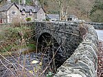
Devil's Bridge, Ceredigion
Bridges completed in 1753Bridges completed in 1901Bridges completed in the 13th centuryBridges in CeredigionBuildings and structures completed in 1200 ... and 6 more
Grade II* listed bridges in WalesGrade II* listed buildings in CeredigionTourist attractions in CeredigionUse British English from September 2014Vale of Rheidol RailwayVillages in Ceredigion

Devil's Bridge (Welsh: Pontarfynach, lit. "The bridge on the Mynach") is a village and community in Ceredigion, Wales. Above the River Mynach on the edge of the village is a series of three stacked bridges, constructed hundreds of years apart, from which the village gets its English name. The village is on the A4120 road, about 10 miles (16 km) east of Aberystwyth. The population of Pontarfynach community at the 2011 census was 455. The mid-2016 estimate suggests that the population had dropped slightly to 429.
Excerpt from the Wikipedia article Devil's Bridge, Ceredigion (License: CC BY-SA 3.0, Authors, Images).Devil's Bridge, Ceredigion
Devil's Bridge,
Geographical coordinates (GPS) Address Nearby Places Show on map
Geographical coordinates (GPS)
| Latitude | Longitude |
|---|---|
| N 52.3768 ° | E -3.85 ° |
Address
Devil's Bridge
Devil's Bridge
SY23 3JL
Wales, United Kingdom
Open on Google Maps


