place

Lessinia Regional Park

1990 establishments in ItalyNature parks of ItalyRegional parks of Italy
Bosco Chiesanuova (Grietz Dossetti Tinazzo) Lessinia VR Italy 2013 04 01 photo CTG ACA LESSINIA Paolo Villa 0058

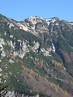
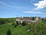
The Lessinia Regional Park (Italian: Parco naturale regionale della Lessinia) is a nature reserve in Veneto, Italy. Established in 1990, it covers the northern part of the Lessinia region, in the Venetian Prealps, between the provinces of Verona and Vicenza. It is both a Special Protection Area and a Site of Community Importance. The park stretches over 10,000 hectares in the territory of fifteen municipalities, thirteen of which belong to the province of Verona and the remaining two to the province of Vicenza; it encompasses all the mountains of the province of Verona, between 1,200 and 1,900 meters above sea level, except for Monte Baldo. The highest point of the park is the peak of Monte Zevola, 1,976 meters above sea level. Agroforestry and silvopasture have played an important role in shaping Lessinia, with much of its territory consisting of pastures – among the most extensive pasturages in the Italian Alps. Cows, sheep (including the Brogna, a breed unique to Lessinia), goats and horses are bred in the region. The park's flora consists of hornbeams, oaks and chestnuts in the valleys, beeches and pines at higher elevations, and alders, mountain pines and rhododendrons at the highest altitudes. The fauna includes red deer, roe deer, chamoises, marmots, foxes, European hares, golden eagles, Eurasian eagle-owls, Western capercaillies, black grouses, hazel grouses, snow buntings, Alpine newts, and fire salamanders. Wolves, which had become extinct in the region in the first half of the 19th century, made their return in 2012, when Slavc, a male wolf coming from Slovenia, formed a breeding pair with Giulietta, a female coming from farther west in the Italian Alps; Giulietta gave birth to at least 42 wolves over the next decade, heavily contributing to the reintroduction of the species in the Eastern Alps. The park was managed by the mountain community of Lessinia until 2019, when a body specifically tasked with its management was created, in compliance with a new regional law. In 2020, five municipalities proposed to cut the park's area by 2,000 hectares, claiming that the park imposed excessive restrictions and bureaucracy on agricultural activities; the proposal was approved by the regional council of Veneto, but dropped following massive protests by environmentalists, including a symbolic march by 10,000 people in the territory of Bosco Chiesanuova, where the seat of the park is located.

Excerpt from the Wikipedia article Lessinia Regional Park (License: CC BY-SA 3.0, Authors, Images).

Lessinia Regional Park
SP14,

Geographical coordinates (GPS) Address Nearby Places
placeShow on map

Wikipedia: Lessinia Regional ParkContinue reading on Wikipedia

Geographical coordinates (GPS)

Latitude Longitude
N 45.683333333333 ° E 11.05 °
placeShow on map

Address

Grotta Campo Rotondo di Sopra

SP14
37021
Veneto, Italy
mapOpen on Google Maps

Bosco Chiesanuova (Grietz Dossetti Tinazzo) Lessinia VR Italy 2013 04 01 photo CTG ACA LESSINIA Paolo Villa 0058
Share experience

Nearby Places

Rotzo Formation
Rotzo Formation

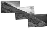
The Rotzo Formation (also known in older literature as the Noriglio Grey Limestone Formation) is a geological formation in Italy, dating to roughly between 192 and 186 million years ago and covering the Pliensbachian stage of the Jurassic Period in the Mesozoic Era. Has been traditionally classified as a Sinemurian-Pliensbachian Formation, but a large and detailed dataset of isotopic 13C and 87Sr/86Sr data, estimated the Rotzo Formation to span only over the Early Pliensbachian, bracketed between the Jamesoni-Davoei biozones, marked in the Loppio Oolitic Limestone–Rotzo Fm contact by a carbon isotope excursion onset similar to the Sinemu-Pliens boundary event, while the other sequences fit with the a warm phase that lasts until the Davoei biozone. The Rotzo Formation represented the Carbonate Platform, being located over the Trento Platform and surrounded by the Massone Oolite (marginal calcarenitic bodies), the Fanes Piccola Encrinite (condensed deposits and emerged lands), the Lombadian Basin Medolo Group and Belluno Basin Soverzene Formation (open marine), and finally towards the south, deep water deposits of the Adriatic Basin. The also Pliensbachian Aganane Formation of Morocco represents a regional equivalent, both in deposition and faunal content. Fossil prosauropod tracks have been reported from the formation. This formation was deposited within a tropical lagoon environment, similar to modern Bahamas which was protected by oolitic shoals and bars from the open deep sea located to the east (Belluno Basin) and towards the west (Lombardia Basin). It is characterized by a rich paleontological content. It is notable mostly thanks to its great amount of big aberrant bivalves, among which is the genus Lithiotis, described in the second half of the nineteenth century. The unusual shape of Lithiotis and Cochlearites shells, extremely elongated and narrow, characterized by a spoon-like body space placed in a high position, rarely preserved, seems to suggest their adaptation to soft and muddy bottoms with a high sedimentation rate. The Bellori outcrop displays about 20 m of limestones with intercalated clays and marls rich in organic matter and sometimes fossil wood (coal) and amber. The limestones are well stratified, with beds 10 cm to more than one metre thick, whereas the clayey levels range between 3 and 40 cm in thickness.