Johnstons Bay
Bays of New South WalesSydney HarbourSydney geography stubsUse Australian English from April 2024

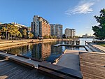
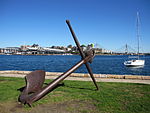
Johnstons Bay is a bay of Port Jackson (Sydney Harbour), between Pyrmont and Balmain, New South Wales, connecting White Bay, Rozelle Bay, Blackwattle Bay, Jones Bay, and Darling Harbour. Johnstons Bay was first spanned by the Glebe Island Bridge, and later by the Anzac Bridge.
Excerpt from the Wikipedia article Johnstons Bay (License: CC BY-SA 3.0, Authors, Images).Johnstons Bay
Johnstons Bay harbour walkway, Sydney Pyrmont
Geographical coordinates (GPS) Address Nearby Places Show on map
Geographical coordinates (GPS)
| Latitude | Longitude |
|---|---|
| N -33.8625 ° | E 151.19111111111 ° |
Address
Johnstons Bay harbour walkway
2009 Sydney, Pyrmont
New South Wales, Australia
Open on Google Maps


