place

Benewah Milk Bottle

1935 establishments in Washington (state)BottlesBuildings and structures in Spokane, WashingtonBurned buildings and structures in the United StatesCommercial buildings completed in 1935
Commercial buildings in Washington (state)Commercial buildings on the National Register of Historic Places in Washington (state)Milk in cultureNational Register of Historic Places in Spokane, WashingtonNovelty buildings in Washington (state)Roadside attractions in Washington (state)Tourist attractions in Spokane, WashingtonWikipedia page with obscure subdivision
Benewah Milk Bottle
Benewah Milk Bottle

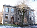
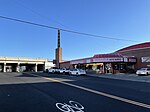
The Benewah Milk Bottle is a landmark in Spokane, Washington. Listed on the National Register of Historic Places, there are two constructed milk bottle-shaped buildings in the Spokane area, which accompanied a successful dairy operation's stores. One of the buildings is located on South Cedar Street in Downtown Spokane, while the other is located two miles north in the Garland Historical District of North Hill. On the morning of September 26, 2011, the Garland Historical District Milk Bottle restaurant, owned by Mary Lou Ritchie, and the historical Ferguson's Café, located next door, were heavily damaged in a fire. Fire investigators believe the fire started in a walkway between the two restaurants.

Excerpt from the Wikipedia article Benewah Milk Bottle (License: CC BY-SA 3.0, Authors, Images).

Benewah Milk Bottle
South Cedar Street, Spokane

Geographical coordinates (GPS) Address Nearby Places
placeShow on map

Wikipedia: Benewah Milk BottleContinue reading on Wikipedia

Geographical coordinates (GPS)

Latitude Longitude
N 47.652777777778 ° E -117.43222222222 °
placeShow on map

Address

Milk Bottle

South Cedar Street
99201 Spokane
Washington, United States
mapOpen on Google Maps

Benewah Milk Bottle
Benewah Milk Bottle
Share experience

Nearby Places

West Downtown Historic Transportation Corridor

The West Downtown Historic Transportation Corridor is a historic commercial district in Spokane, Washington located, as the name suggests, in the western portion of the city's downtown neighborhood. The district, which was listed on the National Register of Historic Places (NRHP) in 1999, consists mostly of buildings constructed between the late 19th century and 1949. It contained at the time of listing 65 buildings or structures, 50 of which are considered contributing properties to the district. Seven properties in the district are listed on the NRHP individually as well.It draws its name from its location along the Union Pacific and BNSF Railways and former route of U.S. Route 10, which ran along First Avenue one block north of the railroad grade. The district was constructed to serve the transportation industry of the railroad and later of the highway as well. Buildings in the district served purposes that originally fell into one of three categories: lodging for travelers, automotive service stations and showrooms, or railroad-dependent warehouses. Most of the buildings are constructed of red brick or reinforced masonry. Prior to the construction of Interstate 90 in the 1960s, most travelers passing through Spokane were funneled through the district. In the decades after the arrival of the interstate, with much of its original purpose no longer in place, the district fell into decline and became a center for blight and crime in the city center. Starting in the late-1990s and continuing into the 2020s, the area has seen considerable investment and revitalization. It is now a vibrant part of the city center, home to numerous boutiques, restaurants, breweries and residences. While the district has largely moved on from its original transport-dependent industries, with the exception of a few hotels which still operate in the area, the visual integrity of the district remains mostly intact.

Ninth Avenue Historic District

The Ninth Avenue Historic District is a National Register of Historic Places (NRHP) listed historic district located along and around Ninth Avenue in the Cliff/Cannon neighborhood of Spokane, Washington. It stretches from Monroe Street on the east to Chestnut Street on the west, running the length of Ninth Avenue and extending to include portions of Eighth, 10th and 11th Avenues, mostly in the western half of the district. A residential area, the district was built to house many of early-Spokane's elite residents in grand Queen Anne, Colonial Revival, Classical Revival, American Foursquare and Tudor Revival homes, along with numerous Bungalow homes for middle-class residents. The area was developed largely between 1892 and 1940, with limited modern incursions in the form of apartments having been built in the decades since. It retains its residential character to this day, though many of the large single-family homes have been converted into multi-unit dwellings. Located roughly one mile from the heart of Downtown Spokane, the Ninth Avenue Historic District is an example of an early residential development in Spokane, free of commercial incursions. Notable architects including Kirtland Cutter, Willis Ritchie, Julius Zittel, Loren L. Rand, John K. Dow and Albert Held designed homes in the district. In the present day, the area is part of the Cliff/Cannon neighborhood of Spokane, stretching from the historic Cannon's Addition in the west over to Monroe Street, a major arterial extending from the north side of Spokane through downtown and up onto the South Hill, in the east. It makes up part of what is now known as the "lower South Hill" for its location near the bottom of a hill which rises abruptly from the downtown area to the north. The terrain surrounding the Ninth Avenue Historic District falls off dramatically on the west to a valley containing Latah Creek, which marks a natural western boundary, and drops to the north to the valley of the Spokane River and Downtown Spokane in the north, while terrain rises to the west and south as one continues up into the South Hill residential area of Spokane.