Riverside Avenue Historic District

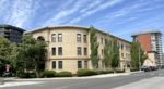
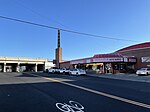
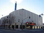
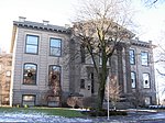
The Riverside Avenue Historic District is a 16.5 acres (6.7 ha) historic district in Downtown Spokane, Washington consisting of buildings constructed in the early 20th century, and was listed on the National Register of Historic Places in 1976. The listing includes 14 contributing properties, nine of which are considered primary and five are considered secondary. The district runs primarily along Riverside Avenue for five blocks from Monroe Street on the east to Walnut Street on the west. Additionally, some adjacent buildings that front Main Street, one block north of Riverside; Sprague Avenue, one block south of Riverside; and Cedar Street, which intersects Riverside in the west are also included. A tree-lined parkway in the middle of the street runs through this stretch of Riverside from Monroe to Cedar, then up Cedar for one block to First Ave.Initially known as the Civic Center due to its concentration of monumental buildings and public spaces, designed and built as part of the City Beautiful movement. Over the years, the district has seen a handful of more modern intrusions within its bounds, but generally retains its historic character. The rear of the buildings are considerably higher than the southern façades, with north-facing walls occasionally being basements.
Excerpt from the Wikipedia article Riverside Avenue Historic District (License: CC BY-SA 3.0, Authors, Images).Riverside Avenue Historic District
West Sprague Avenue, Spokane
Geographical coordinates (GPS) Address Nearby Places Show on map
 Continue reading on Wikipedia
 Geographical coordinates (GPS)
| Latitude | Longitude |
|---|---|
| N 47.6575 ° | E -117.42888888889 ° |
Address
Cathedral Plaza
West Sprague Avenue 1120
99201 Spokane
Washington, United States
Open on Google Maps