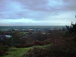
Rubery

Rubery is a village in the Bromsgrove District and a suburb of Birmingham in the counties of Worcestershire and West Midlands, England. It is 9 miles (14 km) from Birmingham city centre and a similar distance from Bromsgrove. Rubery was built on a sandstone quarry, now known as "Rubery Cutting"/"Leach Green Quarry", parts of which can still be seen near the Rubery 'Fly-over'. Former clay mining pits, later flooded and known locally as 'The Marl Holes', now make up Callowbrook Park, which, alongside St Chads Park, is one of the two main parks in the village. Much of the urbanisation in Rubery occurred between 1960 and 1970, where suburbs replaced former farmland and historic farms such as Callowbrook Farm (formally located at the site of Callowbrook Bridge) and Gunner Lane Farm.
Excerpt from the Wikipedia article Rubery (License: CC BY-SA 3.0, Authors, Images).Rubery
Maple Road,
Geographical coordinates (GPS) Address Nearby Places Show on map
Geographical coordinates (GPS)
| Latitude | Longitude |
|---|---|
| N 52.389 ° | E -2.022 ° |
Address
Maple Road
Maple Road
B45 9EA
England, United Kingdom
Open on Google Maps


