place

See Yup temple

19th-century Taoist templesInfobox religious building with unknown affiliationReligious buildings and structures in MelbourneUse Australian English from March 2024

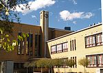
The See Yup Temple (Chinese: 四邑關帝廟) is a heritage-listed Chinese temple located at 76 Raglan Street, South Melbourne, Victoria, Australia. The current building was erected in 1866 for the See Yup Society, as the principal centre of worship and death registry of descendants from the See Yup area in Victoria. The temple is dedicated to Kuan Ti. It also contains halls to Ts'ai Sheng Yeh, the Taoist God of Wealth and to Kuanyin, the Buddhist Goddess of Mercy and Compassion. It is the oldest surviving and continuously operating Chinese temple in Australia.

Excerpt from the Wikipedia article See Yup temple (License: CC BY-SA 3.0, Authors).

See Yup temple
Cobden Street, Melbourne South Melbourne

Geographical coordinates (GPS) Address Nearby Places
placeShow on map

Wikipedia: See Yup templeContinue reading on Wikipedia

Geographical coordinates (GPS)

Latitude Longitude
N -37.8368 ° E 144.9631 °
placeShow on map

Address

See Yup temple

Cobden Street
3205 Melbourne, South Melbourne
Victoria, Australia
mapOpen on Google Maps

Share experience

Nearby Places

St Vincent Place

St Vincent Place is a heritage precinct in Albert Park, Victoria, Australia. St Vincent Place is bounded by Park Street, Cecil Street, Bridport Street, Cardigan Place and Nelson Road. It is bisected by Montague Street, allowing the passage of trams on route 1. It is an example of nineteenth century residential development around the large landscaped square St Vincent Gardens It is characterised by beautiful original terrace houses of the 1860s and 1870s.[1] According to the Victorian Heritage Register, "The St Vincent Place precinct was first designed in 1854 or 55, probably by Andrew Clarke, the Surveyor-General of Victoria. Prior to this, St Vincent's Place, as it is known now, was used as a race track for horses for a period of 9 months or so. The current layout is the work of Clement designers, the noted surveyor, engineer and topographer, who adapted the design in 1857 to allow for its intersection by the St Kilda railway. The precinct, which in its original configuration extended from Park Street in the north to Bridport Street in the south, and from Howe Crescent in the east to Nelson Road and Cardigan Street in the west, was designed to emulate similar 'square' developments in London, although on a grander scale. The main streets were named after British naval heroes. The development of the special character of St Vincent Place has been characterised, since the first land sales in the 1860s, by a variety of housing stock which has included quality row and detached houses dominated by Rochester Terrace (Heritage Register Number 813), and by the gardens which, although they have been continuously developed, remain faithful to the initial landscape concept."[2]