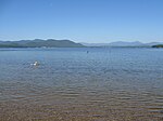
Dan Hole River
New Hampshire river stubsRivers of Carroll County, New HampshireRivers of New Hampshire
The Dan Hole River is a 5.1-mile-long (8.2 km) river in the town of Ossipee in eastern New Hampshire in the United States. Its waters flow via the Beech River, Pine River, Ossipee Lake, the Ossipee River, and the Saco River to the Gulf of Maine, an arm of the Atlantic Ocean. The Dan Hole River begins at the outlet of Dan Hole Pond on the southern edge of the Ossipee Mountains. The river promptly enters Little Dan Hole Pond, then exits from the pond's northern end. The river flows east, past Moultonville, reaching the Beech River just south of the village of Center Ossipee.
Excerpt from the Wikipedia article Dan Hole River (License: CC BY-SA 3.0, Authors).Dan Hole River
Annie Nichols Road,
Geographical coordinates (GPS) Address Nearby Places Show on map
Geographical coordinates (GPS)
| Latitude | Longitude |
|---|---|
| N 43.7475 ° | E -71.148055555556 ° |
Address
Annie Nichols Road 1
03814
New Hampshire, United States
Open on Google Maps


