Casteau

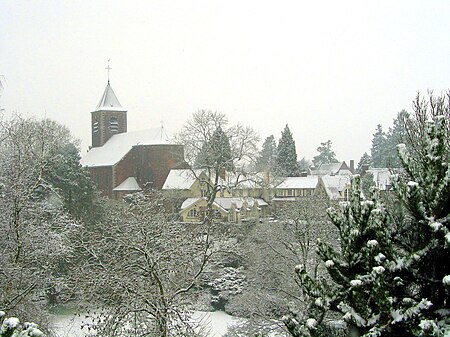
Casteau (Walloon: Castea) originated as a village in the Hainaut province of Wallonia, the French speaking south of Belgium. Casteau has become a district of the municipality of Soignies, centred around Soignies (town), and together with the former villages, now districts: Chaussée-Notre-Dame-Louvignies, Horrues, Naast, Neufvilles, and Thieusies. The village is located between the towns of Mons and Soignies on the road Mons-Brussels. The river Obrecheuil flows through the village. In the past, there were some watermills along the river. Postal code: 7061 Province: Hainaut Municipality: Soignies Demonym: Castellois(e) Elevation: 63 to 115 m (207 to 377 ft) Area: 11,11 km² (4,3 square miles) Time zone: UTC+1
Excerpt from the Wikipedia article Casteau (License: CC BY-SA 3.0, Authors, Images).Casteau
Rue de Lens,
Geographical coordinates (GPS) Address Nearby Places Show on map
Geographical coordinates (GPS)
| Latitude | Longitude |
|---|---|
| N 50.516666666667 ° | E 4 ° |
Address
Rue de Lens
Rue de Lens
7061
Hainaut, Belgium
Open on Google Maps


