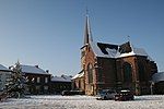
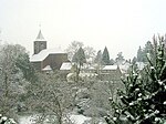
Battle of Saint-Denis (1678)

The Battle of Saint-Denis was the last major action of the Franco-Dutch War (1672-78). It took place on 14 August 1678, four days after Louis XIV of France had agreed the Treaty of Nijmegen with the Dutch Republic, but before he finalised terms with Spain. The battle was initiated by the Dutch and Spanish forces to prevent the French capturing the Spanish-held town of Mons, then on the border between France and the Spanish Netherlands. The result was disputed, as both sides claimed victory. Leaving a small force to maintain the siege of Mons, French commander Luxembourg concentrated 40,000 to 50,000 men around the nearby villages of Saint-Dénis and Casteau, where they were attacked by a combined Dutch-Spanish army of 35,000 to 45,000 men led by William of Orange. In the early stages, the Allies overran the French flanks and forced Luxembourg out of his headquarters in the abbey of Saint-Dénis, but were then pushed back by a series of counter attacks, with many positions changing hands several times. Fighting continued late into the evening, when William pulled his troops back to regroup, leaving the French occupying most of their original lines. The exception was Saint-Denis, whose loss left the French position untenable. When the Allies resumed their attack early next morning, they found Luxembourg had withdrawn overnight and abandoned the siege of Mons. As a result, the town remained Spanish under the treaty agreed with Louis XIV on 17 September.
Excerpt from the Wikipedia article Battle of Saint-Denis (1678) (License: CC BY-SA 3.0, Authors, Images).Battle of Saint-Denis (1678)
Rue des Écoles, Mons
Geographical coordinates (GPS) Address Nearby Places Show on map
Geographical coordinates (GPS)
| Latitude | Longitude |
|---|---|
| N 50.4833 ° | E 4.0167 ° |
Address
Rue des Écoles
Rue des Écoles
7034 Mons
Hainaut, Belgium
Open on Google Maps


