Bury Park
Areas of LutonEngvarB from September 2013

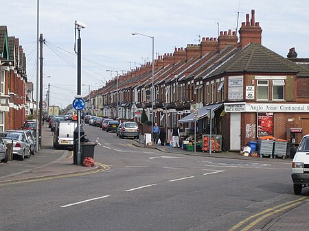
Bury Park is an area of Luton, Bedfordshire, England. It is located 1 mile north west of the town centre on the A505 road to Dunstable. The area is roughly bounded by Claremont Road and Highfield Road to the north, Telford Way to the south, Hatters Way to the west, and the Midland Main Line to the east. Since the mid-1970s a large Muslim community have settled. Bury Park has a large commercial area specialising in fruit, vegetables, tech shops and all cultural clothing. There is a significant number of restaurants in the area, particularly serving Halal food. Kenilworth Road, the home of Luton Town F.C. is also located here.
Excerpt from the Wikipedia article Bury Park (License: CC BY-SA 3.0, Authors, Images).Bury Park
Beech Road,
Geographical coordinates (GPS) Address Nearby Places Show on map
Geographical coordinates (GPS)
| Latitude | Longitude |
|---|---|
| N 51.885 ° | E -0.431 ° |
Address
Beech Road
Beech Road
LU1 1DP , Bury Park
England, United Kingdom
Open on Google Maps


