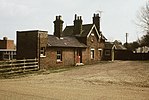
Hyde, Bedfordshire
Bedfordshire geography stubsCentral Bedfordshire DistrictCivil parishes in BedfordshireUse British English from July 2016
Hyde (also known as The Hyde) is a civil parish in the county of Bedfordshire. It lies just south-east of Luton. Most of the land to the west of the River Lea is occupied by the Luton Hoo estate, which includes West Hyde. To the east of the river, the parish contains the ruins of Someries Castle and the hamlets of Chiltern Green, East Hyde and New Mill End. Hyde was served by two railway stations, Luton Hoo and Chiltern Green, but these have since closed.
Excerpt from the Wikipedia article Hyde, Bedfordshire (License: CC BY-SA 3.0, Authors).Hyde, Bedfordshire
Lower Harpenden Road,
Geographical coordinates (GPS) Address Nearby Places Show on map
Geographical coordinates (GPS)
| Latitude | Longitude |
|---|---|
| N 51.8455 ° | E -0.3674 ° |
Address
Lower Harpenden Road
Lower Harpenden Road
LU2 9QB , Hyde
England, United Kingdom
Open on Google Maps


