The Fish Hoek Valley is situated in the Cape Peninsula, eighteen miles south of Cape Town, South Africa. It takes its name from the town of Fish Hoek on the False Bay coast.
The valley is bound by mountains (including Chapman's Peak, Spitskop, Silvermine Mountain, and Ridge Peak) on the north; Fish Hoek Bay and False Bay on the east; mountains (including Elsie's Peak, Rooikrans, and Slangkop) on the south; and Chapman's Bay and the Atlantic Ocean on the west. It is 13 kilometres from west to east, and between 3 and 6 kilometres from north to south. The valley has several rivers and lakes.
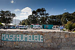
The predominant vegetation type in this valley is endangered Hangklip Sand Fynbos. However, the sides of the valley are home to Cape Granite Fynbos, and Peninsula Sandstone Fynbos can be found higher up on the surrounding mountains. The latter two vegetation types (also both endangered) are endemic to the Cape Peninsula and can be found nowhere else in the world.Fish Hoek Valley was once rural, but today it is largely covered by suburbs and townships such as Kommetjie, Ocean View, Noordhoek, The Lakes, Masiphumelele, Capri Village, Sunnydale, Sun Valley, Fish Hoek, and Clovelly. Some rural aspects have been preserved in the form of heritage areas and parts of the Table Mountain National Park.


