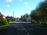
Upper Canterton
Hampshire geography stubsVillages in Hampshire
Upper Canterton is a village in Hampshire, England, located at 50°54′36″N 1°37′24″W. It is near Minstead.
Excerpt from the Wikipedia article Upper Canterton (License: CC BY-SA 3.0, Authors).Upper Canterton
A31, New Forest Minstead
Geographical coordinates (GPS) Address Nearby Places Show on map
Geographical coordinates (GPS)
| Latitude | Longitude |
|---|---|
| N 50.91 ° | E -1.62333 ° |
Address
A31
SO43 7GN New Forest, Minstead
England, United Kingdom
Open on Google Maps


