New Forest District
1974 establishments in EnglandNew Forest DistrictNon-metropolitan districts of HampshirePages with non-numeric formatnum argumentsStates and territories established in 1974

New Forest is a local government district in Hampshire, England. Its council is based in Lyndhurst. The district covers most of the New Forest National Park, from which it takes its name. The district was created on 1 April 1974, under the Local Government Act 1972, by the merger of the municipal borough of Lymington with New Forest Rural District and part of Ringwood and Fordingbridge Rural District. With its population estimated at 179,753 in mid-2018, New Forest is one of the most populated districts in England not to be a unitary authority. It was recommended by the Banham Commission to become one in 1995, but this was vetoed by the government of the day.
Excerpt from the Wikipedia article New Forest District (License: CC BY-SA 3.0, Authors, Images).New Forest District
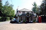
New Forest Minstead
Geographical coordinates (GPS) Address Website Nearby Places Show on map
Geographical coordinates (GPS)
| Latitude | Longitude |
|---|---|
| N 50.879 ° | E -1.633 ° |
Address
Minstead
New Forest, Minstead
England, United Kingdom
Open on Google Maps


