place

Kuhnsville, Pennsylvania

Pages with non-numeric formatnum argumentsUnincorporated communities in Lehigh County, PennsylvaniaUnincorporated communities in PennsylvaniaUse mdy dates from July 2023

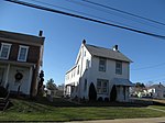
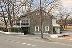
Kuhnsville is a small, unincorporated village in Upper Macungie Township in Lehigh County, Pennsylvania. It is part of the Lehigh Valley, which has a population of 861,899 and is the 68th-most populous metropolitan area in the U.S. as of the 2020 census.

Excerpt from the Wikipedia article Kuhnsville, Pennsylvania (License: CC BY-SA 3.0, Authors).

Kuhnsville, Pennsylvania
Crackersport Road, Upper Macungie Township

Geographical coordinates (GPS) Address Nearby Places
placeShow on map

Wikipedia: Kuhnsville, PennsylvaniaContinue reading on Wikipedia

Geographical coordinates (GPS)

Latitude Longitude
N 40.592222222222 ° E -75.588888888889 °
placeShow on map

Address

Exxon

Crackersport Road
18104 Upper Macungie Township
Pennsylvania, United States
mapOpen on Google Maps

Share experience

Nearby Places

Lehigh County, Pennsylvania

Lehigh County (Pennsylvania Dutch: Lechaa Kaundi) is a county in the Commonwealth of Pennsylvania. As of the 2020 census, the county's population was 374,557. Its county seat is Allentown, the state's third-largest city after Philadelphia and Pittsburgh.Lehigh County and Northampton County to its east combine to form the Lehigh Valley region of eastern Pennsylvania. Lehigh County is one of the fastest-growing counties in Pennsylvania and the more highly populated of the two counties. Both counties are part of the Philadelphia television market, the fourth-largest television market in the nation. The county is named for the Lehigh River, a 109-mile-long (175 km) tributary of the Delaware River, which flows through Lehigh County. The Lehigh River served a vital role in the county's development by offering a transportation and trading route for its mining products, including iron, manganese, limestone, and ultimately manufactured steel products. Lehigh County falls geographically between two Pennsylvania Appalachian mountain ridges, Blue Mountain to the county's north and South Mountain to its south. Lehigh County borders Montgomery County to its south, Bucks County to its southeast, Northampton County to its east, Carbon County to its north, Schuylkill County to its northwest, and Berks County to its southwest. The county is located 61 miles (98 km) northwest of Philadelphia and 99 miles (159 km) west of New York City.

Orefield, Pennsylvania

Orefield is a small unincorporated community in Lehigh County, Pennsylvania. The community is split between North Whitehall and South Whitehall townships. Orefield is part of the Lehigh Valley, which has a population of 861,899 and is the 68th-most populous metropolitan area in the U.S. as of the 2020 census. Located along Pennsylvania Route 309, Orefield has the ZIP Code of 18069. Its name is derived from the extensive deposits of limonite (iron ore) once mined here. It was once the terminus of the Siegersville Branch of the Ironton Railroad, which was extended here to haul the ore. Orefield is the former home to Parkland High School. It is located outside of Allentown. Orefield is surrounded by many suburban housing developments, many of which were former farms operated by the Pennsylvania Dutch whose influence in the community is waning. Several covered bridges nearby cross the Jordan Creek. Located near Orefield is a large factory for Alpo a dog food company, which has been owned by the Ralston Purina Company since the 1990s. Also located nearby are the Jaindl turkey farms; Orefield's turkey farms provide the already-slaughtered turkeys that are presented to the president of the United States each Thanksgiving; the live turkeys that are pardoned at the same presentation come from rotating locations). Located in Orefield is Shankweiler's Drive-In Theatre, the second drive-in ever built (1934) and America's oldest operating drive-in theater.