Stonebridge, London

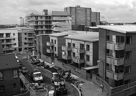
Stonebridge is a locality in the London Borough of Brent that forms the western part of Harlesden in Northwest London, England. The A404 runs through the district known locally as Brentfield and Hillside, while to the south are railway tracks and to the west is the North Circular Road along with Stonebridge Park station. The area is known for the previously troubled 1960s Stonebridge housing estate, which was completely redeveloped in the 2000s. Stonebridge is also the name of the largest electoral ward in the borough, which includes Stonebridge itself as well as Park Royal and the southern half of Neasden including the St Raphael's Estate; it is the most populated ward in Brent with a population over 17,000 with the majority of Afro-Caribbean heritage.
Excerpt from the Wikipedia article Stonebridge, London (License: CC BY-SA 3.0, Authors, Images).Stonebridge, London
Shakespeare Avenue, London Harlesden (London Borough of Brent)
Geographical coordinates (GPS) Address Phone number Website Nearby Places Show on map
Geographical coordinates (GPS)
| Latitude | Longitude |
|---|---|
| N 51.541184 ° | E -0.2638 ° |
Address
The Stonebridge School
Shakespeare Avenue
NW10 8NG London, Harlesden (London Borough of Brent)
England, United Kingdom
Open on Google Maps


