place

Ouse Valley Way

Footpaths in CambridgeshireFootpaths in NorfolkFootpaths in NorthamptonshireGeographic coordinate listsLists of coordinates
Long-distance footpaths in EnglandRiver Great OuseUse British English from December 2016
RiverGreatOuse StNeots 20020609ad

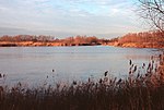
The Ouse Valley Way is a 150-mile (240 km) footpath in England, following the River Great Ouse from its source near Syresham in Northamptonshire to its mouth in The Wash near King's Lynn. The path begins outside the King's Head pub in Syresham (52.0683°N 1.0807°W / 52.0683; -1.0807 (Ouse Valley Way (Syresham trailhead))) and ends on the Green Quay in King's Lynn (52.7512°N 0.3935°E / 52.7512; 0.3935 (Ouse Valley Way (King's Lynn trailhead))). There is a long-term plan to complete remaining gaps in the path, meanwhile it is possible to walk the entire route, although in places the footpath and river temporarily part company. The route passes many interesting places and there is much to see, including attractive countryside, pretty villages, ancient English market towns, churches and a cathedral, and abundant wildlife. Towns from source to mouth include Buckingham, Milton Keynes, Olney, Bedford, St Neots, Huntingdon, St Ives, Ely, Downham Market, and King's Lynn. The route is way-marked and maintained by The Countryside Agency who also provide maps and written guides online. A small section of the Ouse Valley Way is used on the Pathfinder March.

Excerpt from the Wikipedia article Ouse Valley Way (License: CC BY-SA 3.0, Authors, Images).

Ouse Valley Way
Guided Busway bridleway, Huntingdonshire

Geographical coordinates (GPS) Address Nearby Places
placeShow on map

Wikipedia: Ouse Valley WayContinue reading on Wikipedia

Geographical coordinates (GPS)

Latitude Longitude
N 52.3152 ° E -0.0477 °
placeShow on map

Address

Guided Busway bridleway
CB24 4SR Huntingdonshire
England, United Kingdom
mapOpen on Google Maps

RiverGreatOuse StNeots 20020609ad
Share experience

Nearby Places

Fen Drayton
Fen Drayton

Fen Drayton is a small village between Cambridge and St. Ives in Cambridgeshire, England, and between the villages of Fenstanton and Swavesey. The village has a primary school, village hall, tennis courts and football fields, where Drayton Lions Football Club play their home matches, and a pub (The Three Tuns). The church (a Church of England) is dedicated to St Mary the Virgin. The village is close to the A14 and the Cambridgeshire Guided Busway, and is on National Cycle Route 51. According to the 2001 census, it is home to 827 people, living in some 329 dwellings. The population was nearly entirely white (99.3%), with 0.4% Asian/Asian British, and 0.4% of mixed ethnicity. 71.5% of the population were Christian, compared to 1.1% listed under 'other religion' (27.4% claimed 'no religion' or did not state a religion). The population of the civil parish as of the 2011 census is 856Much of the working population commutes to work in one of the larger towns or cities nearby; however, there are also a number of farms in the village, some still active. The village was one of 20 Land Settlement Association sites established in the 1930s to provide small holdings (around 5 acres of land each) for the growing of salad crops. When the scheme was wound up in 1983, Fen Drayton Growers was established as a cooperative to manage sales from the remaining growers. This was wound up in the 1990s, and most former holdings in the village are no longer productive sites.