place

The Old Ferry Boat Inn

Grade II listed pubs in CambridgeshireHuntingdonshirePub stubsReportedly haunted locations in the East of England
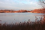
The Ferry Boat Inn and Public House, Holywell geograph.org.uk 309886

The Old Ferry Boat Inn is a pub in Holywell, Huntingdonshire, Cambridgeshire, England. It is situated on the banks of the River Great Ouse.The Old Ferry Boat Inn was established in 560. It claims to be the oldest pub in England. It is Grade II listed.

Excerpt from the Wikipedia article The Old Ferry Boat Inn (License: CC BY-SA 3.0, Authors, Images).

The Old Ferry Boat Inn
Holywell Front, Huntingdonshire Holywell-cum-Needingworth

Geographical coordinates (GPS) Address Nearby Places
placeShow on map

Wikipedia: The Old Ferry Boat InnContinue reading on Wikipedia

Geographical coordinates (GPS)

Latitude Longitude
N 52.3172 ° E -0.0318 °
placeShow on map

Address

Holywell Front
PE27 4TG Huntingdonshire, Holywell-cum-Needingworth
England, United Kingdom
mapOpen on Google Maps

The Ferry Boat Inn and Public House, Holywell geograph.org.uk 309886
Share experience

Nearby Places

Fen Drayton
Fen Drayton

Fen Drayton is a small village between Cambridge and St. Ives in Cambridgeshire, England, and between the villages of Fenstanton and Swavesey. The village has a primary school, village hall, tennis courts and football fields, where Drayton Lions Football Club play their home matches, and a pub (The Three Tuns). The church (a Church of England) is dedicated to St Mary the Virgin. The village is close to the A14 and the Cambridgeshire Guided Busway, and is on National Cycle Route 51. According to the 2001 census, it is home to 827 people, living in some 329 dwellings. The population was nearly entirely white (99.3%), with 0.4% Asian/Asian British, and 0.4% of mixed ethnicity. 71.5% of the population were Christian, compared to 1.1% listed under 'other religion' (27.4% claimed 'no religion' or did not state a religion). The population of the civil parish as of the 2011 census is 856Much of the working population commutes to work in one of the larger towns or cities nearby; however, there are also a number of farms in the village, some still active. The village was one of 20 Land Settlement Association sites established in the 1930s to provide small holdings (around 5 acres of land each) for the growing of salad crops. When the scheme was wound up in 1983, Fen Drayton Growers was established as a cooperative to manage sales from the remaining growers. This was wound up in the 1990s, and most former holdings in the village are no longer productive sites.

Cambridgeshire
Cambridgeshire

Cambridgeshire (abbreviated Cambs.) is a ceremonial county in the East of England and East Anglia. It is bordered by Lincolnshire to the north, Norfolk to the north-east, Suffolk to the east, Essex and Hertfordshire to the south, and Bedfordshire and Northamptonshire to the west. The largest settlement is the city of Peterborough, and the city of Cambridge is the county town. The county has an area of 3,389 km2 (1,309 sq mi) and a population of 852,523. Peterborough (179,349) and Cambridge (145,674), located in the north-west and south respectively, are by far the largest settlements. The remainder of the county is rural, and contains the city of Ely (20,112) and towns such as Wisbech and St Neots. Cambridgeshire contains six local government districts; five are part of a two-tier non-metropolitan county also called Cambridgeshire, and the district of Peterborough is a unitary area. The local authorities collaborate through Cambridgeshire and Peterbrough Combined Authority. The county did not historically include Huntingdonshire or the Soke of Peterborough, which was part of Northamptonshire. The north and east of the county are dominated by the Fens, an extremely flat, drained marsh maintained by drainage ditches and dykes. Holme Fen is the UK's lowest physical point, at 2.75 m (9 ft) below sea level. The flatness of the landscape makes the few areas of higher ground, such as that Ely is built on, very conspicuous. The landscape in the south and west is gently undulating. Cambridgeshire's principal rivers are the Nene, which flows through the north of the county and is canalised east of Peterborough; the Great Ouse, which flows from west to east past Huntingdon and Ely; and the Cam, a tributary of the Great Ouse which flows through Cambridge.