Clark Pond (Maine)
Geography of South Portland, MaineHiking trails in MaineLakes of Cumberland County, Maine

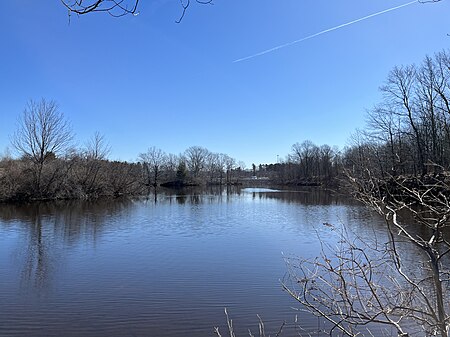
Clark Pond is a freshwater pond in South Portland, Maine, United States. Located near The Maine Mall, it has given its name to Clarks (sic) Pond Parkway, which connects Gorham Road in the north to John Roberts Road in the south, and to the Clarks Pond shopping plaza. The pond, which contains a small island, is fed by Long Creek from the west. It empties out, on the pond's eastern side, eventually leading to the Fore River, about a mile to the northeast. Westbrook Street crosses Long Creek as it leaves Clark Pond to the east. The pond was historically used for recreational activities, as well as ice-production between the 1930s and 1950s.
Excerpt from the Wikipedia article Clark Pond (Maine) (License: CC BY-SA 3.0, Authors, Images).Clark Pond (Maine)
Western Avenue, South Portland
Geographical coordinates (GPS) Address Nearby Places Show on map
Geographical coordinates (GPS)
| Latitude | Longitude |
|---|---|
| N 43.63244119 ° | E -70.31494 ° |
Address
Western Avenue
04106 South Portland
Maine, United States
Open on Google Maps


