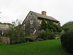
East Hampton, New York

The Town of East Hampton is located in southeastern Suffolk County, New York, at the eastern end of the South Shore of Long Island. It is the easternmost town in the state of New York. At the time of the 2020 United States census, it had a total population of 28,385. The town includes the village of East Hampton, as well as the hamlets of Montauk, Amagansett, Wainscott, and Springs. It also includes part of the incorporated village of Sag Harbor. East Hampton is located on a peninsula, bordered on the south by the Atlantic Ocean, to the east by Block Island Sound and to the north by Gardiners Bay, Napeague Bay and Fort Pond Bay. To the west is western Long Island, reaching to the East River and New York City. The Town has eight state parks, most located at the water's edge. The town consists of 70 square miles (180 km2) and stretches nearly 25 miles (40 km), from Wainscott in the west to Montauk Point in the east. It is approximately six miles (10 km) wide at its widest point and less than one mile at its narrowest. The town has jurisdiction over Gardiners Island, which is one of the largest privately owned islands in the United States. The town has 70 miles (110 km) of shoreline.
Excerpt from the Wikipedia article East Hampton, New York (License: CC BY-SA 3.0, Authors, Images).East Hampton, New York
Mill Hill Lane,
Geographical coordinates (GPS) Address Nearby Places Show on map
Geographical coordinates (GPS)
| Latitude | Longitude |
|---|---|
| N 40.956944444444 ° | E -72.198888888889 ° |
Address
Mill Hill Lane 62
11937
New York, United States
Open on Google Maps


