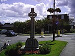
West End, Surrey

West End is a village and civil parish in Surrey Heath, Surrey, England, approximately 25 miles (40 km) southwest of central London. It is midway between the towns of Camberley and Woking, 4 mi (6.4 km) to the west and east respectively. The River Bourne rises from its sources to the immediate west to run through the village. Until the mid 20th century, the West End consisted of a collection of smallholdings surrounded by a substantial area of common land West End Common is comparable in size to Chobham Common to the north and includes training ranges of the British Army. Brentmoor Heath is to the north west of the village. West End is equidistant between Bagshot and Brookwood railway stations, both 3 miles (4.8 km) away. The village is close to junction 3 of the M3 motorway.
Excerpt from the Wikipedia article West End, Surrey (License: CC BY-SA 3.0, Authors, Images).West End, Surrey
Guildford Road, Surrey Heath West End
Geographical coordinates (GPS) Address Nearby Places Show on map
Geographical coordinates (GPS)
| Latitude | Longitude |
|---|---|
| N 51.338 ° | E -0.643 ° |
Address
Guildford Road
GU24 9HJ Surrey Heath, West End
England, United Kingdom
Open on Google Maps


