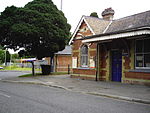
Lightwater

Lightwater is a village in the Surrey Heath district of Surrey, England, about 27 miles (43 km) southwest of central London. Immediately surrounding towns and villages include Bagshot, Deepcut, Windlesham, Camberley, and West End, Woking. It is bounded to the north-west by the M3 motorway and to the north-east by the "Lightwater Bypass" (A322). To the south-east it is bounded by the "Red Road" (B311), while to the south-west there are vehicle-testing tracks owned by the Ministry of Defence. The village is adjacent to junction 3 of the M3 motorway. The nearest railway station is at Bagshot, on the line between Ascot and Aldershot. Lightwater is part of the civil parish of Windlesham, which has a population of 17,000 and also includes the neighbouring village of Bagshot.
Excerpt from the Wikipedia article Lightwater (License: CC BY-SA 3.0, Authors, Images).Lightwater
Ullswater Road, Surrey Heath Windlesham
Geographical coordinates (GPS) Address Nearby Places Show on map
Geographical coordinates (GPS)
| Latitude | Longitude |
|---|---|
| N 51.3506 ° | E -0.6672 ° |
Address
Ullswater Road
Ullswater Road
GU18 5TB Surrey Heath, Windlesham
England, United Kingdom
Open on Google Maps


