Sunset Point (Yarmouth, Maine)

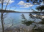
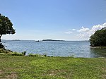
Sunset Point is a promontory in Yarmouth, Maine, United States. It is located 2.65 miles (4.26 km) south of Yarmouth Village and looks out into inner Casco Bay, marking the eastern side of Broad Cove. Sunset Road leads to the point itself. It begins at an intersection with Princes Point Road, Battery Point Lane and Nubbin Reach. In the early 1880s, the adjacent (to the east) Princes Point began to develop as a summer colony. For several years it had become a favorite camping spot for the villagers and the inhabitants of the inland parts of the town who came here for clam bakes and picnics. The town road ended at the John Allen Drinkwater barn, and here a large gate opened into the pasture which included the two points.Around 1884, the first to person to own a lot on at Sunset Point was Samuel O. Carruthers.
Excerpt from the Wikipedia article Sunset Point (Yarmouth, Maine) (License: CC BY-SA 3.0, Authors, Images).Sunset Point (Yarmouth, Maine)
Sunset Point Road,
Geographical coordinates (GPS) Address Nearby Places Show on map
Geographical coordinates (GPS)
| Latitude | Longitude |
|---|---|
| N 43.76221337077 ° | E -70.178504632 ° |
Address
Sunset Point Road 110
04096
Maine, United States
Open on Google Maps


