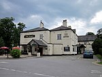
A5117 road
Geographic coordinate listsInfobox road instances in the United KingdomInfobox road maps tracking categoryLists of coordinatesRoads in Cheshire ... and 2 more
Roads in EnglandUse British English from January 2013

The A5117 is a road in Cheshire, England. It runs between Shotwick (53.2374°N 2.9875°W / 53.2374; -2.9875 (A5117 road (western end))) and Helsby (53.2613°N 2.7814°W / 53.2613; -2.7814 (A5117 road (eastern end))) and connects the A550 at Woodbank to the M56. As such it forms a northerly bypass to Chester and a shorter route between the North West and North Wales than the A55.
Excerpt from the Wikipedia article A5117 road (License: CC BY-SA 3.0, Authors, Images).A5117 road
Old Farm Way,
Geographical coordinates (GPS) Address Nearby Places Show on map
Geographical coordinates (GPS)
| Latitude | Longitude |
|---|---|
| N 53.2597 ° | E -2.8839 ° |
Address
Old Farm Way
Old Farm Way
CH2 4HT
England, United Kingdom
Open on Google Maps


