place

Ellesmere Port

Ellesmere PortFormer civil parishes in CheshirePopulated places established in 1795Port cities and towns of the Irish SeaTowns in Cheshire
Unparished areas in CheshireUse British English from April 2021
Fountain in front of Civic Hall geograph.org.uk 422531

Ellesmere Port ( ELZ-meer) is a port town in the Cheshire West and Chester borough in Cheshire, England. Ellesmere Port is on the south eastern edge of the Wirral Peninsula, 6 miles (9.7 km) north of Chester, on the bank of the Manchester Ship Canal. The town had a population of 61,090 in the 2011 census. Ellesmere Port also forms part of the wider Birkenhead urban area, which had a population of 325,264 in 2011.The town was originally established on the River Mersey at the entrance to the Ellesmere Canal. As well as a service sector economy, it has retained large industries including Stanlow oil refinery, a chemical works and the Vauxhall Motors car factory. There are also a number of tourist attractions including the National Waterways Museum, the Blue Planet Aquarium and Cheshire Oaks Designer Outlet.

Excerpt from the Wikipedia article Ellesmere Port (License: CC BY-SA 3.0, Authors, Images).

Ellesmere Port
Grange Road,

Geographical coordinates (GPS) Address Nearby Places
placeShow on map

Wikipedia: Ellesmere PortContinue reading on Wikipedia

Geographical coordinates (GPS)

Latitude Longitude
N 53.279 ° E -2.897 °
placeShow on map

Address

ALDI

Grange Road
CH65 0AR , Wolverham
England, United Kingdom
mapOpen on Google Maps

Fountain in front of Civic Hall geograph.org.uk 422531
Share experience

Nearby Places

Shropshire Union Canal

The Shropshire Union Canal, nicknamed the "Shroppie", is a navigable canal in England. The Llangollen and Montgomery canals are the modern names of branches of the Shropshire Union (SU) system and lie partially in Wales. The canal lies in the counties of Staffordshire, Shropshire and Cheshire in the north-west English Midlands. It links the canal system of the West Midlands, at Wolverhampton, with the River Mersey and Manchester Ship Canal at Ellesmere Port, Cheshire, 66 miles (106 km) distant. The "SU main line" runs southeast from Ellesmere Port on the River Mersey to the Staffordshire and Worcestershire Canal at Autherley Junction in Wolverhampton. Other links are to the Llangollen Canal (at Hurleston Junction), the Middlewich Branch (at Barbridge Junction), which itself connects via the Wardle Canal with the Trent and Mersey Canal, and the River Dee (in Chester). With two connections to the Trent and Mersey (via the Middlewich Branch and the Staffordshire and Worcestershire Canal) the SU is part of an important circular and rural holiday route called the Four Counties Ring. The SU main line was the last trunk narrow canal route to be built in England. It was not completed until 1835 and was the last major civil engineering accomplishment of Thomas Telford. The name "Shropshire Union" comes from the amalgamation of the various component companies (Ellesmere Canal, Birmingham and Liverpool Junction Canal, Montgomeryshire Canal) that came together to form the Shropshire Union Railways and Canal Company. The main line between Nantwich and Autherley Junction was almost built as a railway although eventually it was decided to construct it as a waterway.

Ellesmere Canal
Ellesmere Canal

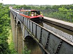
The Ellesmere Canal was a waterway in England and Wales that was planned to carry boat traffic between the rivers Mersey and Severn. The proposal would create a link between the Port of Liverpool and the mineral industries in north east Wales and the manufacturing centres in the West Midlands. However, the canal was never completed as intended because of its rising costs and failure to generate the expected commercial traffic. The Ellesmere Canal, which was first proposed in 1791, would have created a waterway between Netherpool, Cheshire, and Shrewsbury. However, only certain sections were completed; these were eventually incorporated into the Chester Canal, Montgomery Canal and Shropshire Union Canal. Although several major civil engineering feats were accomplished, major building work ceased following the completion of the Pontcysyllte Aqueduct in 1805. The northern end of the navigation's mainline ended 16 miles (25 km) from Chester at Trevor Basin near Ruabon and its southern end was at Weston Lullingfields about 9 miles (15 km) from Shrewsbury. As part of the rebranding of Britain's industrial waterways as leisure destinations, the surviving central section is now called the Llangollen Canal; even though historically its builders had no intention of sending boat traffic to Llangollen. The branch, from which the waterway now takes its name, was primarily a water feeder from the River Dee above the town. Therefore it was not built as a broad-gauge canal, hence its inherently narrow design.