Havering's Grove
Villages in Essex

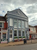
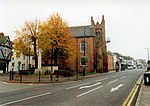
51.6269°N 0.3890°E / 51.6269; 0.3890 Havering’s Grove is a village in Essex, most of which lies in the Borough of Brentwood, with part in the Borough of Basildon. It is situated on the A129 London to Southend Road. The settlement, which developed in the twentieth century, covers an extensive area, but has a low population due to low density nature of the plotland and A129 ribbon developments that constitute most of the village.
Excerpt from the Wikipedia article Havering's Grove (License: CC BY-SA 3.0, Authors, Images).Havering's Grove
London Road, Essex
Geographical coordinates (GPS) Address Nearby Places Show on map
Geographical coordinates (GPS)
| Latitude | Longitude |
|---|---|
| N 51.6269 ° | E 0.389 ° |
Address
London Road
London Road
CM12 9HT Essex, Havering's Grove
England, United Kingdom
Open on Google Maps


