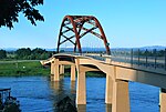
The Columbia Slough is a narrow waterway, about 19 miles (31 km) long, in the floodplain of the Columbia River in the U.S. state of Oregon. From its source in the Portland suburb of Fairview, the Columbia Slough meanders west through Gresham and Portland to the Willamette River, about 1 mile (1.6 km) from the Willamette's confluence with the Columbia. It is a remnant of the historic wetlands between the mouths of the Sandy River to the east and the Willamette River to the west. Levees surround much of the main slough as well as many side sloughs, detached sloughs, and nearby lakes. Drainage district employees control water flows with pumps and floodgates. Tidal fluctuations cause reverse flow on the lower slough.
The Columbia floodplain, formed by geologic processes including lava flows, volcanic eruptions, and the Missoula Floods, is part of the Portland Basin, which extends across the Columbia River from Multnomah County, Oregon, into Clark County, Washington. Five percent of Oregon's population, about 158,000 people, live in the slough watershed of about 51 square miles (130 km2). Municipal wells near the upper slough provide supplemental drinking water to Portland and nearby cities. The cities, the drainage districts, the county, and a regional government, Metro, have overlapping jurisdictions in the watershed. A regional agency operates Portland International Airport along the middle slough and marine terminals near the lower slough. The Oregon Department of Environmental Quality (DEQ) and the city's Bureau of Environmental Services (BES) deal with environmental issues.
Long before non-indigenous people explored the region, tribes of Native Americans fished and hunted along the slough. In the early 19th century fur trappers and explorers including Lewis and Clark visited the area before large migrations of settlers began arriving from the east. The newcomers farmed, cut timber, built houses, and by the early 20th century established cities, shipping ports, roads, rail lines and industries near the slough. Increased investment in the floodplain led to larger losses during floods, and these losses prompted levee building that greatly altered the area. A flood pouring through a levee break in 1948 destroyed the city of Vanport, which was never rebuilt.
Used as a waste repository during the first half of the 20th century and cut off from the Columbia River by levees, the slough became one of Oregon's most polluted waterways. Early attempts to mitigate the pollution, which included raw sewage and industrial waste, were unsuccessful. However, in 1952 Portland began sewage treatment, and over the next six decades the federal Clean Water Act and similar legislation mandated further cleanup. State and local governments, often assisted by community volunteers, undertook projects related to public health, natural resources, and recreation in a region with many homes, industries, businesses, and roads. The businesses and industries in the watershed employ about 57,000 people, which is also frequented by more than 150 bird species and 26 fish species and animals including otters, beaver, and coyotes. One of the nation's largest freshwater urban wetlands, Smith and Bybee Wetlands Natural Area, shares the lower slough watershed with a sewage treatment plant, marine terminals, a golf course, and a car racetrack. Watercraft able to portage over culverts and levees can travel the entire length of the slough. The 40-Mile Loop and other hiking and biking trails follow the waterways and connect the parks.


