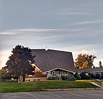
Britannia Village, Ottawa

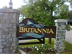
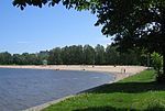
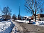
Britannia Village (est. 1818) has a rich history and architecture, having been founded some eight years before Bytown (est. 1826), the former name of Ottawa, Ontario, Canada. The history of the village is interwoven with the creation of the adjacent Britannia Amusement Park, today simply known as Britannia Park. The character of villagers is significantly influenced by its natural surroundings. Geographically, the village is located on a broad peninsula and is largely defined by natural boundaries. According to the Ottawa Neighborhood Study, the village is bordered by the Ottawa River to the North, Lac Deschênes and Britannia Park to the west, the Trans Canada Trail to the south, and Mud Lake (Britannia Conservation Area) to the east. Lac Deschênes is home to 4 sailing clubs including the Britannia Yacht Club which is located in the village. The village also borders on Britannia Beach, one of four beaches in Ottawa. Britannia Road is the only road into and out of the village and the only access to the Britannia Water Purification Plant.The village has a total population of 610 people in 270 private households; it is a sub-neighborhood of the Britannia area of Bay Ward, in the west end of Ottawa about 13 km from the Canadian Parliament Buildings. The village has an active association (Britannia Village Community Association or BVCA) and a community Facebook page (Friends of Britannia Village).
Excerpt from the Wikipedia article Britannia Village, Ottawa (License: CC BY-SA 3.0, Authors, Images).Britannia Village, Ottawa
Jamieson Street, Ottawa
Geographical coordinates (GPS) Address Nearby Places Show on map
Geographical coordinates (GPS)
| Latitude | Longitude |
|---|---|
| N 45.368805555556 ° | E -75.799777777778 ° |
Address
Jamieson Street 2750
K2B 5X3 Ottawa
Ontario, Canada
Open on Google Maps
