place

Belltown, Ottawa

Neighbourhoods in OttawaUse Canadian English from January 2023
BelltownDome
BelltownDome

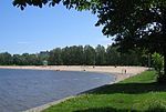
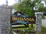
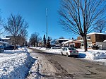
Belltown is a neighbourhood in the Britannia area of Bay Ward, in the west end of Ottawa. It is bounded on the east by Britannia Park, on the north by the Ottawa River, on the west by Andrew Haydon Park and the south by Carling Avenue. Prior to Ottawa's amalgamation in 2001, the neighbourhood spanned the Ottawa-Nepean municipal boundary. The neighbourhood's population is 2089 (2016 Census), with 294 people living in the Nepean portion.

Excerpt from the Wikipedia article Belltown, Ottawa (License: CC BY-SA 3.0, Authors, Images).

Belltown, Ottawa
Haughton Avenue, Ottawa

Geographical coordinates (GPS) Address Nearby Places
placeShow on map

Wikipedia: Belltown, OttawaContinue reading on Wikipedia

Geographical coordinates (GPS)

Latitude Longitude
N 45.360555555556 ° E -75.802222222222 °
placeShow on map

Address

Haughton Avenue 2878
K2B 6Z9 Ottawa
Ontario, Canada
mapOpen on Google Maps

BelltownDome
BelltownDome
Share experience

Nearby Places

Lincoln Fields Shopping Centre

Lincoln Fields Shopping Centre (later Lincoln Heights Galleria) was a community mall located in the Lincoln Heights neighbourhood of Ottawa, Ontario, Canada. It was located between Carling Avenue and Richmond Road just west of Lincoln Fields station. In October 2019, the mall was closed due to changing demographics in the area and departure of the Walmart store.Lincoln Fields Shopping Centre was developed out of a project named "Cinema City", proposed in 1964. The proposed CA$25 million complex would feature over 80 stores across three floors, a three-screen movie theatre and four luxury apartment buildings with a planned opening date of March 1967. However, the following years saw no development. The project was repeatedly scaled down and expected construction costs rose to $85 million. The site's original developers eventually sold the land to a new team who instead proposed a $3.8 million single-story shopping mall. The mall broke ground on June 9, 1971 and opened on May 24, 1972, becoming the city's third enclosed shopping centre. In 1985, the mall underwent renovations and was rebranded as Lincoln Heights Galleria, though residents continued referring to the mall as "Lincoln Fields".In 2016, the Walmart store closed and relocated to Bayshore Shopping Centre. This cause the mall to lose a significant portion of its clientele. In November 2018, the Wendy's restaurant, housed in a separate building fronting Carling Avenue, burned down in a fire that police said was deliberately set.In January 2019, it was announced the mall's leases would terminate on July 31 of that year. The mall's eastern half was demolished in summer 2020. This left the Rexall and Metro stores in operation until they moved into two newly built spaces the following year. The mall's western half was demolished in 2021. Long-term development plans by RioCan include high-density residential towers on the site.

Lincoln Heights, Ottawa

Lincoln Heights (also known as Lincoln Heights - Parkway) is a neighbourhood in the Britannia area of Bay Ward in the west end of Ottawa, Ontario, Canada. It is defined by its community association as being bounded to the south by the north side of Regina Lane (now Starflower Lane), to the north by the Ottawa River, to the west by the east side of Croydon Avenue, and to the east by the Kichi Zibi Mikan (formerly the Sir John A. Macdonald Parkway). According to the Canada 2016 Census, the population of the neighbourhood is 1,630. The greater Lincoln Heights area can be defined as extending as far west as Greenview Avenue and as far south as Carling Avenue, which overlaps with neighbouring Britannia Village. The area is notable for its proximity to the Ottawa River and Mud Lake bird sanctuary. Lincoln Fields transit station is the main transit hub in the neighbourhood, and Lincoln Fields Shopping Centre was the main commercial centre before closing in 2019. Construction plans for the neighbourhood were announced in 1958 by Assaly Construction Limited, with plans for a $20,000,000 "luxury sub-division" on the site of the Magee farm. The neighbourhood began to be built c. 1960 on Regina Street. Following the removal of the Canadian Pacific Railway line (where today's Plover Lane is), the neighbourhood expanded further north in the early 1970s with the construction of Lincoln Heights Road.There are many high-rise condominiums and apartments in the neighbourhood. The Old Forge Community Resource Centre, which is located in a historic building, is a key community centre. Carlingwood Shopping Centre is just east of Lincoln Fields at the corner of Carling and Woodroffe Avenue.