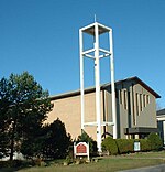
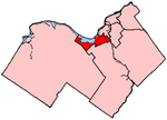
Qualicum-Graham Park or Qualicum is a suburban neighbourhood in College Ward in the City of Ottawa, Ontario, Canada. It is located in the former City of Nepean in the west end of the city. Many of the residences in the area are executive homes situated on large lots (100x100) being built in the 1960s. Qualicum Street boasts large custom houses built by Bill Teron. The neighbourhood is bounded to the north by the Queensway, to the west by Richmond Road, to the south by Baseline Road, and to the east by Morrison Drive at the former Ottawa-Nepean border towards Redwood. Named after Qualicum Beach in British Columbia.
According to the Canada 2011 Census, the total population of the neighbourhood was 1,715.Most of the streets are named after Aboriginal peoples and towns in British Columbia. The following streets are located in the community:
Aleutian Road- named after the Aleutian Islands in Alaska.
Chinook Crescent- the Chinook winds in the Canadian Prairies.
Cowichan Way- named after the Cowichan peoples in BC.
Esquimalt Avenue- a town on Vancouver Island. One of the main streets in the neighborhood; starts at Beaumaris and ends at Okanagan
Kitimat Crescent-Town in northwestern British Columbia
Kitsilano Court- Named after a suburb in Vancouver, British Columbia. Located at the former Graham Park Public School grounds in Qualicum-Graham Park. Built in 2015.
Mohawk Crescent- Named after the Mohawk people. The tribe is located in the St. Lawrence Region; Southern Quebec, Eastern Ontario, and Northern New York.
Nanaimo Drive-A town in Vancouver Island. Another main street in the neighbourhood.
Okanagan Drive- Named after the Okanagan Valley around the Rocky Mountains in BC. Starts at Nanaimo Drive, which curves and ends at Baseline Road.
Qualicum Street- Named after Qualicum Beach on Vancouver Island. Qualicum street is parallel along Baseline Road. Starts at Draper Avenue and ends at Esquimalt Avenue.
Sioux Crescent- Named after the Sioux in the Northern United States(Minnesota, Dakotas, Iowa and Montana) and the Prairies in Central Canada (Alberta, Manitoba and Saskatchewan).


