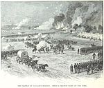
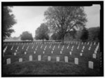
The Battle of Glendale, also known as the Battle of Frayser's Farm, Frazier's Farm, Nelson's Farm, Charles City Crossroads, New Market Road, or Riddell's Shop, took place on June 30, 1862, in Henrico County, Virginia, on the sixth day of the Seven Days Battles (Peninsula Campaign) of the American Civil War.General Robert E. Lee ordered his Confederate divisions of the Army of Northern Virginia, under the field command of Major Generals Benjamin Huger, James Longstreet, and A.P. Hill, to converge upon Union Major General George B. McClellan's retreating Army of the Potomac in transit in the vicinity of Glendale (or Frayser's Farm), attempting to catch it in the flank and destroy it in detail. The Army of the Potomac was moving out of the White Oak Swamp on a retreat from the Chickahominy River to the James River following the perceived defeat at the Battle of Gaines' Mill; as the Union Army approached the Glendale crossroad, it was forced to turn southward with its right flank exposed to the west. Lee's goal was to thrust a multi-pronged attack of his divisions into the Army of the Potomac near the Glendale crossroad, where a vanguard of Union defenders was caught largely unaware.
The coordinated assault envisioned by Lee failed to materialize due to difficulties encountered by Huger and unspirited efforts made by Major General Thomas J. "Stonewall" Jackson, but successful attacks made by Longstreet and Hill near the Glendale crossroad penetrated the Union defenses near Willis Church and temporarily breached the line. Union counterattacks sealed the breach and turned the Confederates back, repulsing their attack upon the line of retreat along the Willis Church/Quaker Road through brutal close-quarters hand-to-hand fighting. North of Glendale, Huger's advance was stopped on the Charles City Road. Near the White Oak Swamp Bridge, the divisions led by Jackson were simultaneously delayed by Union Brigadier General William B. Franklin's corps at White Oak Swamp. South of Glendale near Malvern Hill, Confederate Major General Theophilus H. Holmes made a feeble attempt to attack the Union left flank at Turkey Bridge but was driven back.
The battle was Lee's best chance to cut off the Union Army from the safety of the James River, and his efforts to bisect the Federal line failed. The Army of the Potomac successfully retreated to the James, and that night, the Union army established a strong position on Malvern Hill.


