place

Brampton, North East Derbyshire

Civil parishes in DerbyshireNorth East Derbyshire District
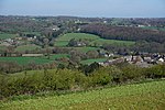
Church of St Peter and St Paul, Old Brampton geograph.org.uk 2313722

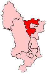
Brampton is a civil parish within the North East Derbyshire district, which is in the county of Derbyshire, England. Named for its main settlement, with a mix of a number of villages and hamlets amongst a large rural area, it had a population of 1,201 residents in 2011. The parish is 130 miles (210 km) north west of London, 20 miles (32 km) north of the county city of Derby, and 2 miles (3.2 km) west of the nearest market town of Chesterfield. Brampton encompasses a portion of the Peak District national park to the west, and shares a border with the district of Chesterfield, along with the parishes of Barlow, Baslow and Bubnell, Beeley, as well as Holymoorside and Walton. The parish does not include the nearby built-up suburb of Brampton which is now within the Chesterfield unparished area.

Excerpt from the Wikipedia article Brampton, North East Derbyshire (License: CC BY-SA 3.0, Authors, Images).

Brampton, North East Derbyshire
Hollins, North East Derbyshire Brampton

Geographical coordinates (GPS) Address Nearby Places
placeShow on map

Wikipedia: Brampton, North East DerbyshireContinue reading on Wikipedia

Geographical coordinates (GPS)

Latitude Longitude
N 53.241 ° E -1.524 °
placeShow on map

Address

Royal Oak

Hollins
S42 7JR North East Derbyshire, Brampton
England, United Kingdom
mapOpen on Google Maps

Church of St Peter and St Paul, Old Brampton geograph.org.uk 2313722
Share experience

Nearby Places

North East Derbyshire

North East Derbyshire is a local government district in Derbyshire, England. It borders the districts of Chesterfield, Bolsover, Amber Valley and Derbyshire Dales in Derbyshire, and Sheffield and Rotherham in South Yorkshire. The population of the district as taken at the 2011 Census was 99,023. The district council is a non-constituent partner member of the Sheffield City Region Combined Authority. In 2011, it formed a joint working arrangement with Bolsover District Council. Under this arrangement the two councils operate shared senior management roles. Other management roles and teams are also shared. The council's head office was originally based outside the district, in the town of Chesterfield, which the district surrounds on three sides, and thus acts as the shopping and work centre for much of the district. However the council relocated to District Council Offices, Mill Lane, Wingerworth, within its own administrative area, in April 2015. Settlements in the district include: Arkwright Town and Ashover Barlow Calow and Clay Cross Dronfield Eckington Grassmoor Holmesfield, Holymoorside and Holmewood Killamarsh Morton North Wingfield Pilsley Renishaw and Ridgeway Shirland, Spinkhill and Stonebroom Tupton WingerworthThe district was formed on 1 April 1974 under the Local Government Act 1972. It was a merger of the Clay Cross and Dronfield urban districts along with all but one parish of Chesterfield Rural District.