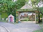
North East Derbyshire

North East Derbyshire is a local government district in Derbyshire, England. It borders the districts of Chesterfield, Bolsover, Amber Valley and Derbyshire Dales in Derbyshire, and Sheffield and Rotherham in South Yorkshire. The population of the district as taken at the 2011 Census was 99,023. The district council is a non-constituent partner member of the Sheffield City Region Combined Authority. In 2011, it formed a joint working arrangement with Bolsover District Council. Under this arrangement the two councils operate shared senior management roles. Other management roles and teams are also shared. The council's head office was originally based outside the district, in the town of Chesterfield, which the district surrounds on three sides, and thus acts as the shopping and work centre for much of the district. However the council relocated to District Council Offices, Mill Lane, Wingerworth, within its own administrative area, in April 2015. Settlements in the district include: Arkwright Town and Ashover Barlow Calow and Clay Cross Dronfield Eckington Grassmoor Holmesfield, Holymoorside and Holmewood Killamarsh Morton North Wingfield Pilsley Renishaw and Ridgeway Shirland, Spinkhill and Stonebroom Tupton WingerworthThe district was formed on 1 April 1974 under the Local Government Act 1972. It was a merger of the Clay Cross and Dronfield urban districts along with all but one parish of Chesterfield Rural District.
Excerpt from the Wikipedia article North East Derbyshire (License: CC BY-SA 3.0, Authors, Images).North East Derbyshire
Darley Road, North East Derbyshire
Geographical coordinates (GPS) Address Nearby Places Show on map
Geographical coordinates (GPS)
| Latitude | Longitude |
|---|---|
| N 53.2 ° | E -1.5 ° |
Address
Darley Road
Darley Road
S45 0LW North East Derbyshire
England, United Kingdom
Open on Google Maps


