Holymoorside
AC with 0 elementsNorth East Derbyshire DistrictTowns and villages of the Peak DistrictVillages in Derbyshire

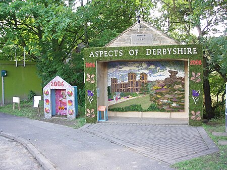
Holymoorside is a village in the civil parish of Holymoorside and Walton, in the North East Derbyshire district, in the county of Derbyshire, England, approximately two miles west of Chesterfield. It is located at 53.21 North, -1.49 West. Close to the boundary of the Peak District National Park, Chatsworth House lies seven miles to the west of the village. In 2020 it had an estimated population of 1,419.
Excerpt from the Wikipedia article Holymoorside (License: CC BY-SA 3.0, Authors, Images).Holymoorside
High Lane, North East Derbyshire Holymoorside and Walton
Geographical coordinates (GPS) Address Nearby Places Show on map
Geographical coordinates (GPS)
| Latitude | Longitude |
|---|---|
| N 53.21 ° | E -1.49 ° |
Address
High Lane
High Lane
S42 7LL North East Derbyshire, Holymoorside and Walton
England, United Kingdom
Open on Google Maps


