Unthank, Derbyshire
Derbyshire geography stubsHamlets in DerbyshireNorth East Derbyshire District

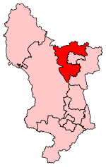
Unthank is a hamlet in the North East Derbyshire district of Derbyshire, England. It is sited on a narrow lane on the southern slopes of the Cordwell Valley, at an altitude of about 185 metres (610 ft).On 6 May 1970, a USAF McDonnell-Douglas RF-4C crashed in the nearby Stripes Wood while doing a NATO training exercise. Both crew men ejected and landed at Curbar Edge.
Excerpt from the Wikipedia article Unthank, Derbyshire (License: CC BY-SA 3.0, Authors, Images).Unthank, Derbyshire
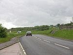
Unthank Lane, North East Derbyshire Holmesfield
Geographical coordinates (GPS) Address Nearby Places Show on map
Geographical coordinates (GPS)
| Latitude | Longitude |
|---|---|
| N 53.2808 ° | E -1.5394 ° |
Address
Unthank Lane
Unthank Lane
S18 7WF North East Derbyshire, Holmesfield
England, United Kingdom
Open on Google Maps


