Barlow, Derbyshire
Civil parishes in DerbyshireNorth East Derbyshire DistrictOpenDomesdayTowns and villages of the Peak DistrictVillages in Derbyshire

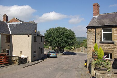
Barlow is a village and civil parish in the North East Derbyshire district of Derbyshire, England. According to the 2001 census the parish had a population of 884, increasing to 920 at the 2011 Census. The village is about 4 miles north-west of Chesterfield.
Excerpt from the Wikipedia article Barlow, Derbyshire (License: CC BY-SA 3.0, Authors, Images).Barlow, Derbyshire
Hackney Lane, North East Derbyshire
Geographical coordinates (GPS) Address Nearby Places Show on map
Geographical coordinates (GPS)
| Latitude | Longitude |
|---|---|
| N 53.268 ° | E -1.484 ° |
Address
Hackney Lane
S18 7TD North East Derbyshire
England, United Kingdom
Open on Google Maps


