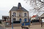
Mantes-la-Ville
Communes of YvelinesPages including recorded pronunciationsPages with French IPAPages with disabled graphsYvelines geography stubs

Mantes-la-Ville (French pronunciation: [mɑ̃t la vil] ) is a commune in the Yvelines department in the Île-de-France region in north-central France. It is located in the western suburbs of Paris 48.6 km (30.2 mi) from the center. Mantes-la-Ville is located at the confluence of the Seine and the Vaucouleurs. The Paris–Rouen rail line separates Mantes-la-Ville from the larger commune of Mantes-la-Jolie. The A13 autoroute to Normandy also passes through Mantes-la-Ville.
Excerpt from the Wikipedia article Mantes-la-Ville (License: CC BY-SA 3.0, Authors, Images).Mantes-la-Ville
Rue Saint-Étienne, Mantes-la-Jolie
Geographical coordinates (GPS) Address Nearby Places Show on map
Geographical coordinates (GPS)
| Latitude | Longitude |
|---|---|
| N 48.975 ° | E 1.7117 ° |
Address
Rue Saint-Étienne
Rue Saint-Étienne
78711 Mantes-la-Jolie
Ile-de-France, France
Open on Google Maps


