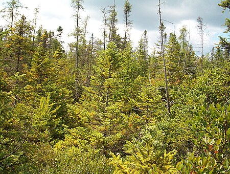
Tannersville Cranberry Bog

The Tannersville Cranberry Bog or Cranberry Swamp is a sphagnum bog on the Cranberry Creek in Tannersville, Pennsylvania. It is the southernmost boreal bog east of the Mississippi River, containing many black spruce and tamarack trees at the southern limit of their ranges. Technically, it can be classed as an acid fen, as it receives some groundwater flow. The site was designated a National Natural Landmark in December 1974. It was purchased by The Nature Conservancy and the Conservation and Research Foundation in 1957. Like many bogs, its terrain presents an image of solidity, but a liquid mass of decaying peat lies beneath a six-inch (152 mm) layer of sphagnum and a network of supporting tree roots. However, this bog may be viewed from a floating walkway.
Excerpt from the Wikipedia article Tannersville Cranberry Bog (License: CC BY-SA 3.0, Authors, Images).Tannersville Cranberry Bog
Cherry Lane Road,
Geographical coordinates (GPS) Address Website Nearby Places Show on map
Geographical coordinates (GPS)
| Latitude | Longitude |
|---|---|
| N 41.042222222222 ° | E -75.258888888889 ° |
Address
Tannersville Cranberry Bog Preserve
Cherry Lane Road 552
18301
Pennsylvania, United States
Open on Google Maps


