place

Clapton, Gloucestershire

Civil parishes in GloucestershireCotswold DistrictGloucestershire geography stubsUse British English from September 2021Villages in Gloucestershire
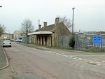
Clapton on the Hill geograph.org.uk 215016

Clapton, also known as Clapton-on-the-Hill, is a small village and civil parish in the district of Cotswold, in the county of Gloucestershire, England. As of 2019, it has a population of 110.

Excerpt from the Wikipedia article Clapton, Gloucestershire (License: CC BY-SA 3.0, Authors, Images).

Clapton, Gloucestershire
Cotswold District Clapton

Geographical coordinates (GPS) Address Nearby Places
placeShow on map

Wikipedia: Clapton, GloucestershireContinue reading on Wikipedia

Geographical coordinates (GPS)

Latitude Longitude
N 51.8596 ° E -1.7649 °
placeShow on map

Address


GL54 2LG Cotswold District, Clapton
England, United Kingdom
mapOpen on Google Maps

Clapton on the Hill geograph.org.uk 215016
Share experience

Nearby Places

Salmonsbury Meadows SSSI

Salmonsbury Meadows (grid reference SP178213) is an 18-hectare (44-acre) biological and geological Site of Special Scientific Interest in Gloucestershire, notified in 1985. The site is listed in the 'Cotswold District' Local Plan 2001-2011 (on line) as a Key Wildlife Site (KWS).The site is owned and managed by the Gloucestershire Wildlife Trust, and is part of its Greystones Farm nature reserve (grid reference SP173209). The reserves lie to the east of Bourton-on-the-Water, which is in the Cotswolds. The site, which includes the Site of Special Scientific Interest (SSSI), was bought in three phases over four years. Salmonsbury Meadows were purchased first in 1999. This was followed in 2000 by the Restoration area, which is a 15.9-hectare (39-acre) area of improved grassland adjacent to the SSSI. The third part acquired in 2002 secured the whole farm. This final acquisition included Salmonsbury Camp (ramparts are visible), which is a Scheduled Ancient Monument. The nature reserve is a 66-hectare (160-acre) site. The River Eye runs through the meadows and the River Dikler forms the eastern boundary. There is a network of public footpaths and the long-distance Oxfordshire Way crosses the farm.There is fuller history of Greystones Farm, its meadows and Salmonsbury Camp in a publication produced by the Gloucestershire Wildlife Trust. Further information may be found on the Dobunni, a Celtic tribe which inhabited this area (Iron Age period).