Ditton, Kent
Civil parishes in KentLocal Nature Reserves in KentUse British English from January 2014Villages in Kent

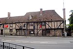
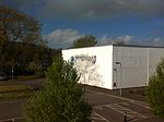
Ditton is a large village and civil parish in the borough of Tonbridge and Malling in Kent, England. The village is 4.6 miles (7.4 km) west-northwest of Maidstone and 1.8 miles (2.9 km) east of West Malling. The parish, which is long and narrow, straddles the A20 (the old Dover to London road), with farmland to the south and industry to the north. It lies in the Medway Valley, on the northern edge of the Kent Weald, and adjoins the ancient parishes of Larkfield, Aylesford and Barming.
Excerpt from the Wikipedia article Ditton, Kent (License: CC BY-SA 3.0, Authors, Images).Ditton, Kent
Kiln Barn Road, Tonbridge and Malling Ditton
Geographical coordinates (GPS) Address Nearby Places Show on map
Geographical coordinates (GPS)
| Latitude | Longitude |
|---|---|
| N 51.29485 ° | E 0.4519 ° |
Address
Kiln Barn Road
Kiln Barn Road
ME20 6AH Tonbridge and Malling, Ditton
England, United Kingdom
Open on Google Maps


