place

Castleton, Staten Island

Former towns in New York CityGeography of Staten IslandHistory of Staten IslandStaten Island geography stubs
Richmond County (Staten Island) cropped from Richmond Queens Kings counties map by David Burr 1839

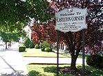
Castleton is a former town in the U.S. state of New York. It was located in the northeastern part of Staten Island prior to the incorporation of Staten Island into New York City in 1898. It had a total area of 3880 acres (15.7 km²) and was bounded by Upper New York Bay on the east and the Kill Van Kull on the north. The town dates from the late 17th century. It was originally set aside as the manor of the governor of the Province of New York and takes its name from the manor of Governor Thomas Dongan who named it for his home Castletown, in the town Kildrought (now Celbridge) in County Kildare, Ireland. The original manor house was constructed along Richmond Terrace, between Dongan Street and Bodine Street. It was destroyed by fire on December 25, 1878. The town was incorporated by the state of New York in 1788.The town was dissolved in 1898 upon consolidation into the City of New York. The former town included the present-day neighborhoods of Castleton Corners New Brighton St. George Silver Lake Tompkinsville

Excerpt from the Wikipedia article Castleton, Staten Island (License: CC BY-SA 3.0, Authors, Images).

Castleton, Staten Island
Windsor Court, New York Staten Island

Geographical coordinates (GPS) Address Nearby Places
placeShow on map

Wikipedia: Castleton, Staten IslandContinue reading on Wikipedia

Geographical coordinates (GPS)

Latitude Longitude
N 40.6124 ° E -74.1154 °
placeShow on map

Address

Windsor Court

Windsor Court
10314 New York, Staten Island
New York, United States
mapOpen on Google Maps

Richmond County (Staten Island) cropped from Richmond Queens Kings counties map by David Burr 1839
Share experience

Nearby Places

Clove Lakes Park
Clove Lakes Park

Clove Lakes Park is a public park in the Sunnyside neighborhood of Staten Island in New York City.Clove Lakes Park has a rich natural history with valuable ecological assets and a few remnants of the past. Chief among them are the park's lakes and ponds, outcroppings of serpentine rocks, and Staten Island's largest living thing, a 119-foot-tall (36 m) tulip tree. Clove Lakes Park is home to many species of indigenous wildlife. Visitors can see fish such as black crappie, brown bullhead, bluegill, emerald shiner, pumpkinseed, largemouth bass, and carp; birds such as red-tailed hawk, belted kingfisher, double-crested cormorant, red-winged blackbird, Canada goose, heron, egret and mallard; as well as reptiles and amphibians, like the common snapping turtle, eastern painted turtle, red-eared slider, and occasionally even the red-backed salamander. The park is also home to mammals such as eastern gray squirrel, muskrat, eastern cottontail, and eastern chipmunk. The park is known for its cozy picnic accommodations and boating. Besides strolling down trails and paddling on its bodies of water, visitors can experience the park as a more modern recreation zone. Several baseball diamonds, a soccer field, basketball court, playgrounds, and a football field dot the park's landscape. The Staten Island World War II Veteran's Memorial Ice Skating Rink is an outdoor rink located in what could be called the "active" part of the park, close to its other fields and courts. The park also contains a restaurant overlooking Clove Lake, and the borough headquarters of the city's Department of Parks and Recreation. The park consists of three lakes: the main one is Clove Lake, which runs off to Martling Lake, and then to Brooks Lake. The Staten Island Expressway, part of Interstate 278, built in 1964, goes through a cleft just south of the park, connecting the then newly-built Verrazzano-Narrows Bridge in the east with the Goethals Bridge in the west. When first proposed, the expressway was to be named the Clove Lake Expressway.