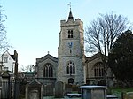
Chiswick High Road

Chiswick High Road is the principal shopping and dining street of Chiswick, a district in the west of London. It was part of the main Roman road running west out of London, and remained the main road until the 1950s when the A4 was built across Chiswick. By the 19th century the road through the village of Turnham Green had grand houses beside it. The road developed into a shopping centre when Chiswick became built up with new streets and housing to the north of Old Chiswick, late in the 19th century. There are several listed buildings including public houses, churches, and a former power station, built to supply electricity to the tram network.
Excerpt from the Wikipedia article Chiswick High Road (License: CC BY-SA 3.0, Authors, Images).Chiswick High Road
Chiswick High Road, London Grove Park (London Borough of Hounslow)
Geographical coordinates (GPS) Address Nearby Places Show on map
Geographical coordinates (GPS)
| Latitude | Longitude |
|---|---|
| N 51.49301 ° | E -0.26708 ° |
Address
Chiswick High Road 442
W4 4HJ London, Grove Park (London Borough of Hounslow)
England, United Kingdom
Open on Google Maps


