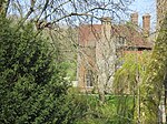
Ashcombe Bottom
AC with 0 elementsNational Trust properties in East SussexNature reserves in East Sussex

Ashcombe Bottom (TQ 373 119) is a 66 hectare (163 acre) woodland valley owned by the National Trust that runs south from Blackcap, East Sussex, England. The area is nested in the South Downs and can only be reached by walking or cycling from Lewes, Falmer, Ditchling Beacon or up the Clayton to Offham escarpment from Plumpton. It sits in the parish of St John Without and East Chiltington. The name Ashcombe refers to a Saxon named Aecci, not ash trees as might be assumed. It is part of the Clayton to Offham Escarpment Site of Special Scientific Interest.
Excerpt from the Wikipedia article Ashcombe Bottom (License: CC BY-SA 3.0, Authors, Images).Ashcombe Bottom
Geographical coordinates (GPS) Address Nearby Places Show on map
Geographical coordinates (GPS)
| Latitude | Longitude |
|---|---|
| N 50.89 ° | E -0.048 ° |
Address
St. John (Without)
, St. John (Without)
England, United Kingdom
Open on Google Maps


