Vauxhall, New Jersey
Census-designated places in New JerseyCensus-designated places in Union County, New JerseyUnincorporated communities in New JerseyUnincorporated communities in Union County, New JerseyUnion Township, Union County, New Jersey ... and 2 more
Use American English from October 2022Use mdy dates from October 2022
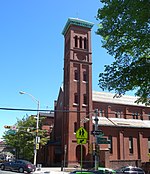
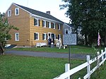
Vauxhall is an unincorporated community and census-designated place (CDP) located within Union Township in Union County, in the U.S. state of New Jersey. Vauxhall borders Millburn, Maplewood and Springfield. The area is served as United States Postal Service ZIP Code 07088.As of the 2010 United States Census, the population for ZIP Code Tabulation Area 07088 was 3,606.Vauxhall is home to The Home Depot Superstore, that at 217,000 square feet (20,200 m2) was the chain's largest store in the world as of 2012.
Excerpt from the Wikipedia article Vauxhall, New Jersey (License: CC BY-SA 3.0, Authors).Vauxhall, New Jersey
Vauxhall Road,
Geographical coordinates (GPS) Address Nearby Places Show on map
Geographical coordinates (GPS)
| Latitude | Longitude |
|---|---|
| N 40.718333333333 ° | E -74.284166666667 ° |
Address
Vauxhall Road 2812
07083
New Jersey, United States
Open on Google Maps


