Petergensfeld
Liège geography stubsRaeren
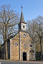
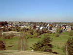
Petergensfeld is a district of the Belgian municipality of Raeren in the German-speaking community. It is located directly on the German-Belgian border and represents the western continuation of the German village Roetgen. Petergensfeld is located around 18 kilometers southeast of Aachen on the northeastern edge of the High Fens on the river Weser. In addition to the standard German taught in school and used in the community, the traditional regional "Platt" is a Ripuarian dialect.
Excerpt from the Wikipedia article Petergensfeld (License: CC BY-SA 3.0, Authors).Petergensfeld
Spanisch,
Geographical coordinates (GPS) Address Nearby Places Show on map
Geographical coordinates (GPS)
| Latitude | Longitude |
|---|---|
| N 50.649 ° | E 6.18 ° |
Address
Spanisch 10
4730 (Raeren)
Liège, Belgium
Open on Google Maps


