Kornelimünster/Walheim
Aachen
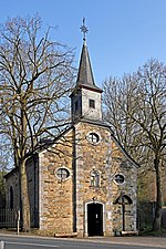
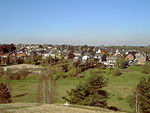
Kornelimünster/Walheim is the southernmost Stadtbezirk (borough) of Aachen, Germany, and borders the Eifel area of North Rhine-Westphalia, as well as Belgium. It became part of Aachen in 1972, after all of the communities surrounding the city were reorganized administratively. The countryside is called Münsterländchen.
Excerpt from the Wikipedia article Kornelimünster/Walheim (License: CC BY-SA 3.0, Authors).Kornelimünster/Walheim
Eurensteg, Aachen Kornelimünster (Kornelimünster/Walheim)
Geographical coordinates (GPS) Address Nearby Places Show on map
Geographical coordinates (GPS)
| Latitude | Longitude |
|---|---|
| N 50.721388888889 ° | E 6.1802777777778 ° |
Address
Eurensteg 1
52076 Aachen, Kornelimünster (Kornelimünster/Walheim)
North Rhine-Westphalia, Germany
Open on Google Maps


