Steling
Geography of Liège ProvinceMonschauMountains and hills of North Rhine-WestphaliaMountains and hills of the EifelMountains under 1000 metres

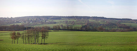
The Steling is a mountain, 658.3 m above sea level (NN) on the High Fens plateau. The German-Belgian border runs 60 meters from the mountaintop. The closest borderpoint near the summit is also the highest point in the municipal region of Aachen.
Excerpt from the Wikipedia article Steling (License: CC BY-SA 3.0, Authors, Images).Steling
Waaneschlachswääsch,
Geographical coordinates (GPS) Address Website Nearby Places Show on map
Geographical coordinates (GPS)
| Latitude | Longitude |
|---|---|
| N 50.5786 ° | E 6.21192 ° |
Address
Waaneschlachswääsch
52156 , Mützenich
North Rhine-Westphalia, Germany
Open on Google Maps


