Dutch Island (Rhode Island)
1636 establishments in Rhode Island1636 establishments in the Dutch EmpireFormer Dutch coloniesForts in Rhode IslandFur trade ... and 6 more
Islands of Narragansett BayIslands of Newport County, Rhode IslandIslands of Rhode IslandJamestown, Rhode IslandNew NetherlandWorld War II prisoner-of-war camps in the United States

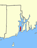
Dutch Island is an island lying west of Conanicut Island at an entrance to Narragansett Bay in Rhode Island, United States. It is part of the town of Jamestown, Rhode Island, and has a land area of 0.4156 km² (102.7 acres). It was uninhabited as of the United States Census, 2000. The island was fortified from the American Civil War through World War II and was known as Fort Greble from 1898 to 1947.
Excerpt from the Wikipedia article Dutch Island (Rhode Island) (License: CC BY-SA 3.0, Authors, Images).Dutch Island (Rhode Island)
Fort Getty Road,
Geographical coordinates (GPS) Address External links Nearby Places Show on map
Geographical coordinates (GPS)
| Latitude | Longitude |
|---|---|
| N 41.503888888889 ° | E -71.4 ° |
Address
Dutch Island
Fort Getty Road
02874
Rhode Island, United States
Open on Google Maps


